Hilary barr
Toronto-based Data Professional
Data and analytics professional bringing together technology and design to deliver better digital public services.
YorkTrax
Salesforce, Geocortex Essentials, and ArcGIS for Server
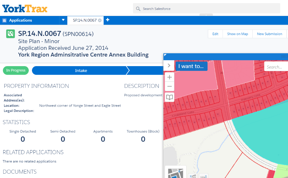
YorkTrax
Integrated GIS with Salesforce to streamline development tracking, consolidate isolated systems, reduce data duplication, and collaborate with partner municipalities.
- Client: York Region
- Year: 2017
Land Transaction Management
Masterworks, Geocortex Essentials, and ArcGIS for Server
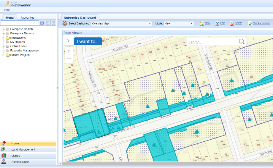
Land Transaction Management
Integrated GIS with Masterworks to manage and centralize land transaction data, provide a clear process for recording transactions, and solidify spatial data as a critical component to land acquisition and disposition.
- Client: York Region
- Year: 2017
Transportation Active Operating Picture
Geocortex Essentials & ESRI Geoevent Server
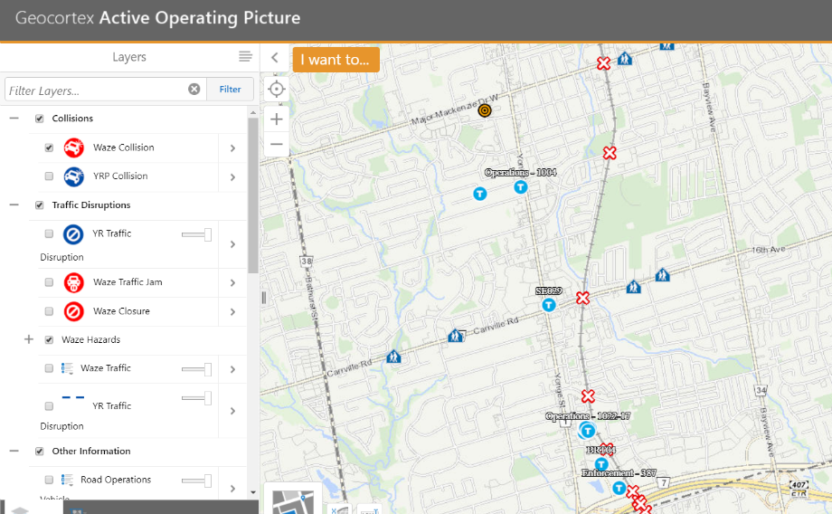
Transportation Active Operating Picture
Common operating picture that allows traffic operations staff to visualize current traffic status and improve the reliability of travel throughout York Region. Real-time data such as Waze, bluetooth travel time, and Fleet vehicles were integrated.
- Client: York Region
- Year: 2019
York Region Business Directory
Geocortex Essentials & ArcGIS for Server
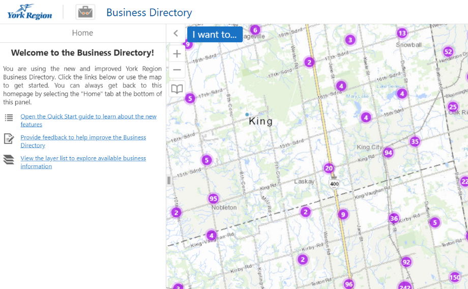
York Region Business Directory
Illustrates the results of the annual Region-wide door-to-door survey of all businesses with a physical presence in the Region.
- Client: York Region
- Year: 2016
Sochi 2014 Web Application
Adobe Flash & Adobe ActionScript
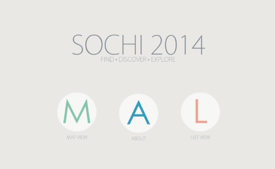
Sochi 2014 Web Application
Web application to explore the results of the 2014 Sochi Olympics. Information includes medal counts, athlete participation, and the events which nations participated in.
- Client: Radio Laurier
- Year: 2014
Undergradute Thesis
ESRI ArcMap, Microsoft Word, and Microsoft Excel
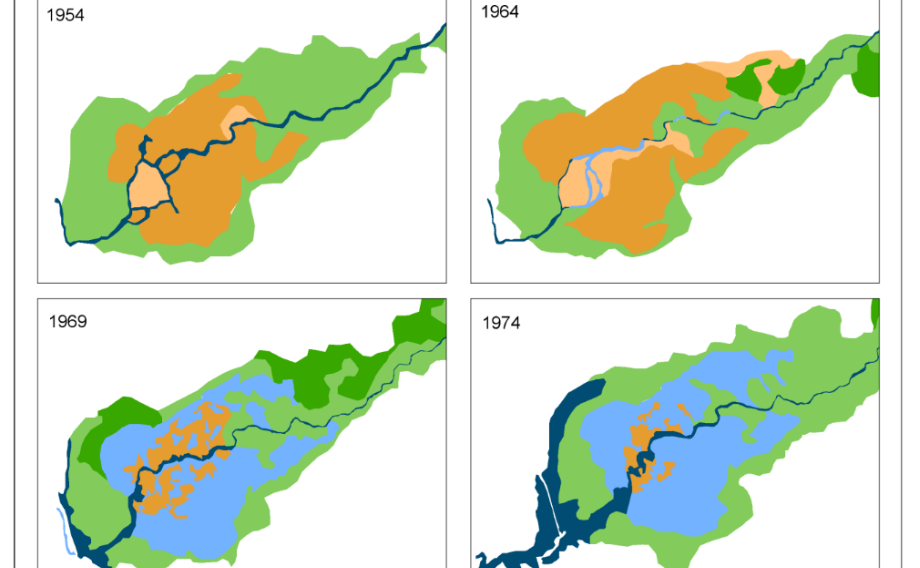
Wetland Hydrology and Land Cover Change Mapping
This study maps the land cover and hydrology changes that have occurred in Skinner’s Marsh, Hepworth, Ontario, since the construction of a dam in 1967.
- Client: Wilfrid Laurier University
- Year: 2013
About Me
Data professional with 10 years of experience. Proven success in project planning and implementation to support digital transformation. Effective communicator, problem solver, and innovator.
For a summary of my experience and education, please view my CV below.
